Planning a Well |
Top Previous Next |
|
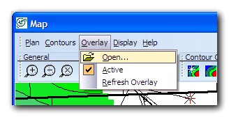
Before you plan a well, it is recommended that you load an overlay into the Directional Well Modules Map window. From the menu, choose Overlay > Open and select an overlay that you have saved in your Map module. This will let you easily quality check the coordinates that you will be entering for surface, landing, and bottom hole locations.
Using the Zoom functionality, zoom in to the area in which you would like to plan a well:
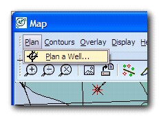
In the Map menu bar, select Plan > Plan A Well
An option dialog box will pop up with the following options:
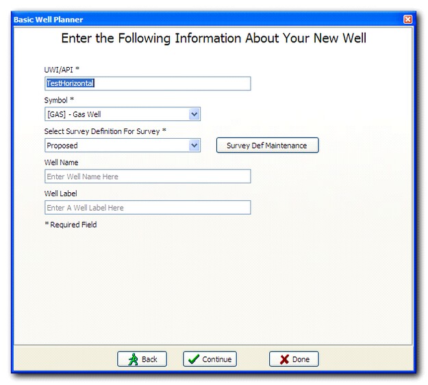
To plan a new well in your database, select Create A New Well and press Continue.
Enter in:
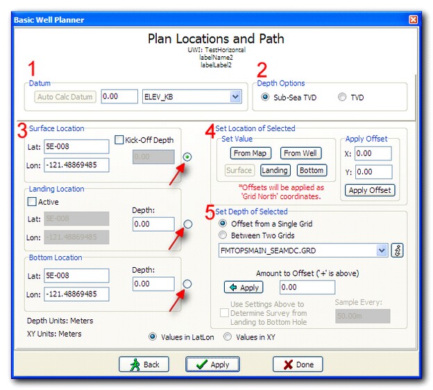
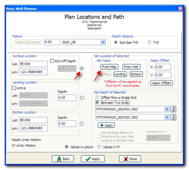
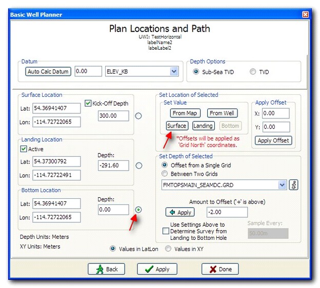
Press Continue. Plan Locations and Path:
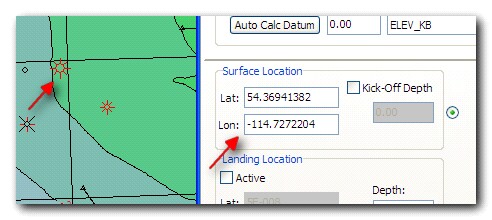
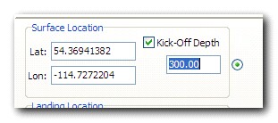
Press Apply to see your changes in a profile view. A more detailed workflow sequence example is: Pick a Surface Location from a map:
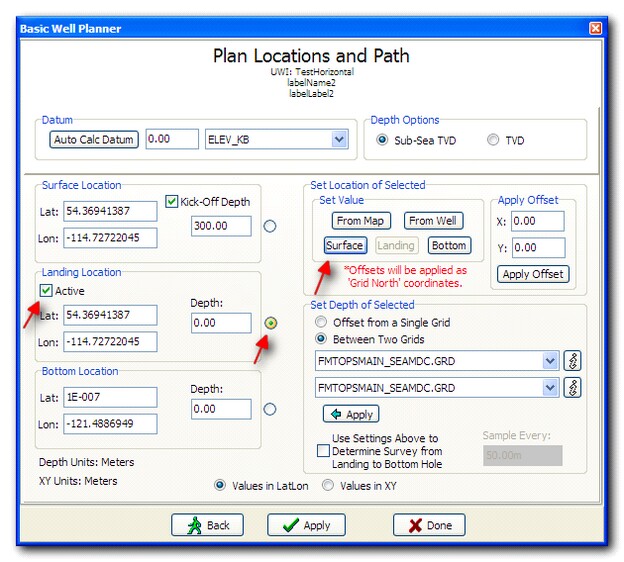
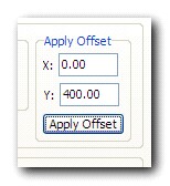
Create a Landing Location from offsets:
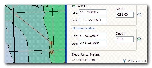
Pick a Bottom Location from the map.
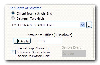
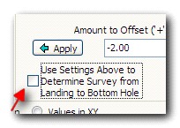
If you simply add a depth point for the Landing Location and another depth point for the Bottom Location, Petra will plan the well in a straight line between those two points. If you have significant topographical changes along the well path, you may wish to sample the well to a surface (or between two surfaces) along the wellbore. To do this, check the Use Settings Above To Determine Survey from Landing to Bottom Hole checkbox, ensure your settings are correct (sampling to one or two grids, offset) and press Apply.
The difference is shown below. With two points along the wellbore (Landing Location and Bottom Location):
Sampling to the Top of Coal Seam surface:
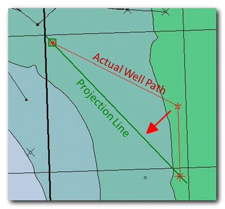
Press Apply to add your newly planned well to the Petra database. To make changes to your well, simply change the desired values in the dialog and press Apply. When you are satisfied with your planned well, you can press Done to exit the planning screen. Note About Projected View: When working with a horizontal well with an offset (or offplane) landing location and a lateral bend, Petra projects the well path onto a straight line drawn between the surface and bottom hole locations. The difference in the projection of grids and borehole path may cause an apparent depth issue in the projected view with respect to the landing location:
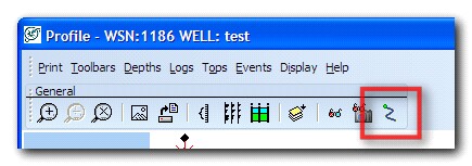
To resolve this apparent discrepancy, you can view your profile un-projected, or along the actual well path. To toggle this setting, press the Enable/Disable TVD vs Offset Mode button on the menu bar:
The un-projected view will show the actual landing location in relation to the surface in question:
|