|
Petra can import and display cartographic data from a variety of sources. This can include "culture" data like roads, or geological data like contour lines. This data is stored in the open overlay file.
To import overlay data, select Overlay>Import from the menu bar at the top of the Map Module.
File tab
The file tab sets the location of the file, and how the data will be stored in the overlay.
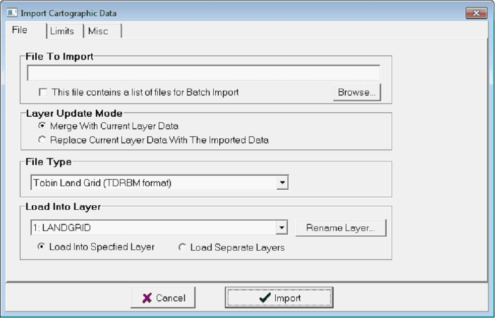
Selecting a file, file type, and destination overlay layer with the File tab
File To Import - This option selects the desired file to import. Select the "Browse" button to navigate to the desired file.
Layer Update Mode - This option sets how Petra treats data in the destination overlay layer. "Merge with Current Layer Data" will add the data from the file into the overlay layer, while "Replace Current Later With The Imported Data" will completely erase the selected overlay layer and overwrite it with the imported data.
File Type - This dropdown selects the file type of the imported data.
Load Into Layer - This option sets the overlay layer that will store the imported data. The "Rename Layer" button will rename the currently selected overlay layer.
Load into Specified Layer - This option brings all the imported data into a single layer.
Load Separate Layers - This option attempts to differentiate between the different overlay items in the imported file and place them into separate layers.
Limits tab
The Limits tab sets the boundary limits of the import, which are shown by the longitude and latitude boxes.
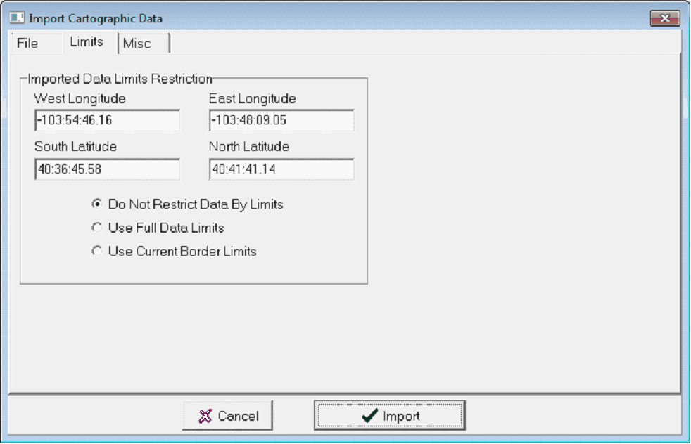
The Import Cartographic Data Limits tab
Do Not Restrict Data By Limits The entire file is loaded, regardless of location.
Use Full Data Limits This option only imports data inside the area defined by selected wells in the map module.
Use Current Border Limits Data inside the current, completely zoomed out data limits (set in the Map Module under Display>Data Limits>Set/Enter Limits) is loaded.
Misc tab
The Misc tab deals with some of the tweaks necessary for certain data types.
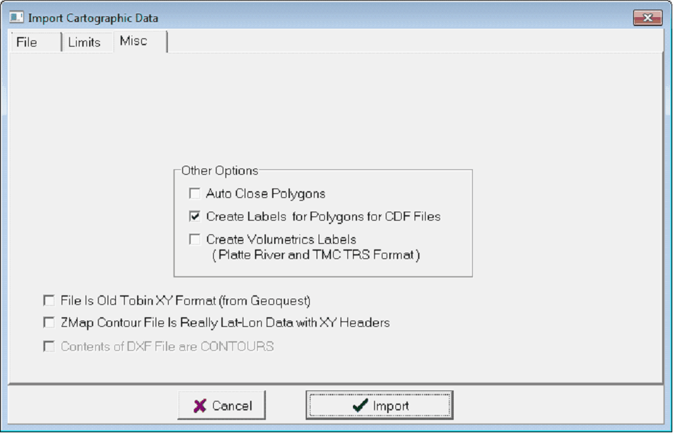
The Import Cartographic Misc tab
Auto Close Polygons this automatically closes all polylines in a layer during import. This can be useful when importing polygons like contours or lease polygons.
Create Labels for Polygons for CDF Files - This automatically creates overlay text labels for CDF Culture files.
Create Volumetrics Labels This creates appropriate volumetric polygon names that are accessible in the Overlay Line Attribute box under the "Volm" tab.
File is Old Tobin XY Format Old (mid 1980's) Tobin files have a different file format. This option helps with backwards compatibility.
ZMap Contour File is Really Lat-Lon Data with XY Headers This tells Petra to ignore bad header data in a ZMap file and import Longitude and Latitude data as such.
Translate tab
Some file formats encode specific information about each entity in the file. Petra can use a "translation file" to sort the cartographic data in a file directly into specified overlay layers.
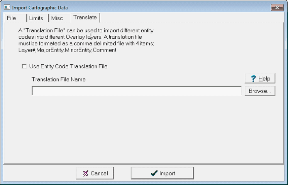
Use Entity Code Translation File - This entry enables sorting by the translation file. Note that if a translation file is enabled, only entities matching the file will be imported into the overlay file. Data not translated by the file will not make it into the overlay file.
Translation File Name - This entry sets the location of the translation file.
File Types
Tobin Land Grid (TBRBM)
Tobin Infobase
Platte River Assoc. TwnRgeSec
Z-Map Plus Vertex association
Z-Map Plus Text
Contour SegID
Digitized Contours (X,Y,Z) and (Lon,Lat,Z)
Z-Map Plus ASCII Contours
Landmark ASCII Metafile
TMC Township/Range Format
TMC Texas Landgrid
GES Cartographic Data Format (CDF)
Z-Map Fault File (X,Y, SegID)
ESRI Shape File (LatLon) and (XY)
AutoCAD DXF (LatLon) and (XY)
InfoPipe MID-MIF
GeoQuest CPS-3 Contours
MapInfo MID-MIF
Petra ASCII Overlay File
SMT Planimeter File
WhiteStar CartoBase File
Tobin GII
AccuMap Grid File (GRD)
AccuMap Culture File (CDF)
|