Datum tab |
|
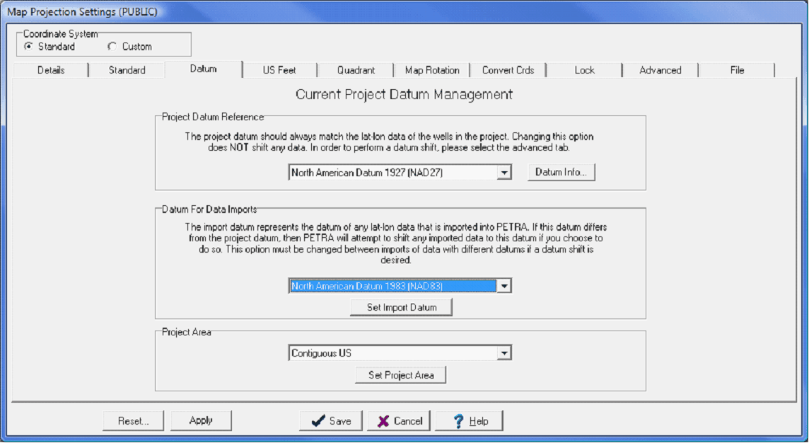
The Datum tab has two major functions: selecting a reference datum at the beginning of a project, and selecting the reference datum for new data imports.
The Map Projection Datum tab Project Datum Reference - This dropdown sets the projects reference datum, which is critical to correctly projecting all well, seismic, and overlay data. After changing the datum, its necessary to select a coordinate system in order to save any changes. Its important to note that changing the projects datum here does not reproject the entire project. Really, the only time to use this option on the Datum tab is when setting up the projects map projection before importing any data. To change the datum of the project, select the Advanced tab on the Map Projection Settings box. Datum for Data Imports - This dropdown automatically recalculates the imported datas latitude and longitude to match the projects reference datum. In the example below, the incoming well datas LatLons are based on the NAD27 reference datum, while the project is based on the NAD83 datum. Project Area - This option sets the list of available reference datums. The Contiguous US option lists only the datums relevant to the US, while the International option shows all available datums.
|