Details tab |
|
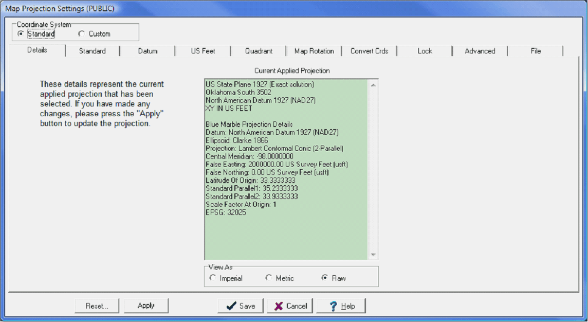
The Details tab simply shows the projects current map projection. The example below shows that the NAD27 reference datum is selected, along with the Oklahoma South state plane coordinate system.
The Details tab displays the current map projection for the project |