|
The next step is to set the depths for the correlation tool. In the main screen, click the "Depths" button on the guide, or click the depths button on the top toolbar:
 . .
General tab
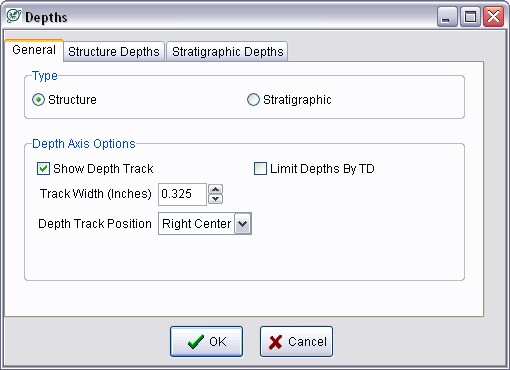
The General tab sets the type of cross section, as well as the specifics of the depth track.

Depth Type
The depth type can be either "Structure" or "Stratigraphic". A structural cross-section has a depth interval defined by measured or SubSea depths. A stratigraphic section instead has depths defined with formation tops, where the raster logs are hung on the upper fm top. Stratigraphic cross-sections are useful for showing variation in stratigraphy independent of structural change.
Depth Axis Options
Show Depth Track This option toggles the display of the small track that shows MD, TVD, or SS depths. To hide it, deselect the "Show Depth Track" option. Hiding the depth track will also hide any perf and test information.
Limit Depths By TD This option limits the drawn raster logs and the depth track down to a well's TD (as stored in Petra's database) rather than to full extents of the bottom set with the Structure or Stratigraphic Depths tabs.
Track Width - This governs the width of the depth track. Text inside the depth track is automatically scaled. Expanding the track width of the Depth Track can make the measured depth numbers easier to read.
Structure Depths
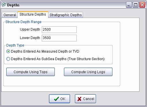
This tab to sets depths for structural plots.

Upper Depth/Lower Depth - These entry boxes set the boundaries for the cross section. Depth values can be entered as either measured or subsea depths. Remember that subsea values below sea level (like those on wells drilled on the Gulf Coast) are are negative from 0.
Compute Using Tops Petra can automatically compute a valid structure depth range from the tops selected for the cross-section. If no tops are picked for the selected wells, Petra won't be able to calculate a depth range.
Compute Using Logs - Petra can automatically compute a valid structure depth range from the logs selected for display. Here, Petra will calculate depths that will cover the top of the shallowest and bottom of the deepest logs.
Stratigraphic Depths
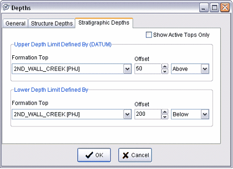
This tab sets the depths for stratigraphic plots.

Upper/Lower Depth Limit Defined by (DATUM) - These dropdowns select the formation tops that define the upper and lower boundaries of the stratigraphic plot. Note that Petra will flatten the wells along the upper formation. You can also add an "offset" number, which allow stratigraphic depths to include data a set number of feet or meters above and below the selected tops. It's also acceptable to use the same formation top for both the upper and lower depth limits with a sufficient offset above and below, as in the example below. Notice that the upper and lower depth limits are set by the same top with offsets 50' above and 200' below.
It's worth noting that if either of these formation tops are null for a well, Petra doesn't have anything to flatten on and the well will be blank. For initial correlation work, it is generally best to pick a consistent, widely correlated top to flatten on.
|