Compute Well Borehole Length |
|
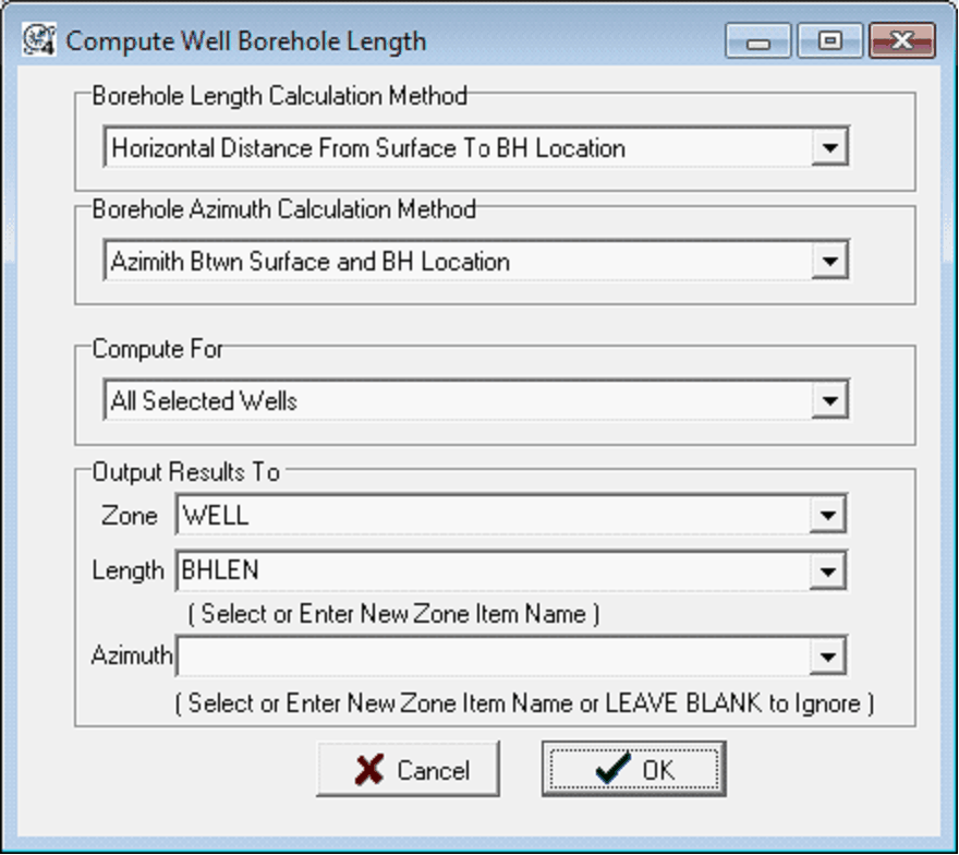
This tool calculates the length of boreholes inside the project and stores the length and optional azimuth to user-selected zone data items. To calculate well borehole length, select Compute>From Locations>Compute Distance from Surface to BH Location from the menu bar at the top of the Main Module.
Borehole Length Calculation Method This option controls how the tool calculates the length of the borehole. Horizontal Distance From Surface to BH Location - This method just calculates the distance from the surface location's LatLon to the bottom hole location's LatLon. This method does not factor in any depths. XYZ Distance From Surface to BH Location at TD - This method calculates the direct linear distance between the surface and bottom hole location at depth. Borehole Azimuth Calculation MethodAzimuth Btwn Surface and BH Location - This method uses the azimuth between the surface location and the bottom hole location. This option is a good choice for most, but can be skewed by a sudden deviation at the end of the lateral. Local Azimuth Near BH Location - This method uses the azimuth immediately around the bottom hole location. Compute ForAll Selected Wells - This option attempts to calculate borehole lengths for all selected wells in the Main Module. Deviated Wells with Dev Survey - This option limits the borehole length calculation to only wells with a directional survey. Deviated Wells Without Dev Survey (use BH Location) - This option limits the borehole length calculation to wells without directional survey data. This option will only use BH locations listed on the Main Module's Location tab. Use BH Location Only (ignore Dev survey) - This option will perform the borehoe length calculation to any well with a difference between the surface and bottom hole location. Note that this method will ignore directional survey data, and will only use bottom hole locations. Output Results ToThese entries set the zone and data item to store the output borehole length. Zone - This dropdown selects the zone that will store the length (and optionally the azimuth) data item. By default, this is the WELL zone. Length - This dropdown selects the data item that will contain the length data item. Note that you can select an existing data item, or enter the name of a new data item. By default, this dropdown is set to BHLEN. Azimuth - This dropdown saves the azimuth used in the calculation to a data item. This will reflect the "Borehole Azimuth Calculation Method" selected above. Leaving this dropdown blank will not save the azimuth value.
|