Pseudo Dir Surveys |
Top Previous Next |
|
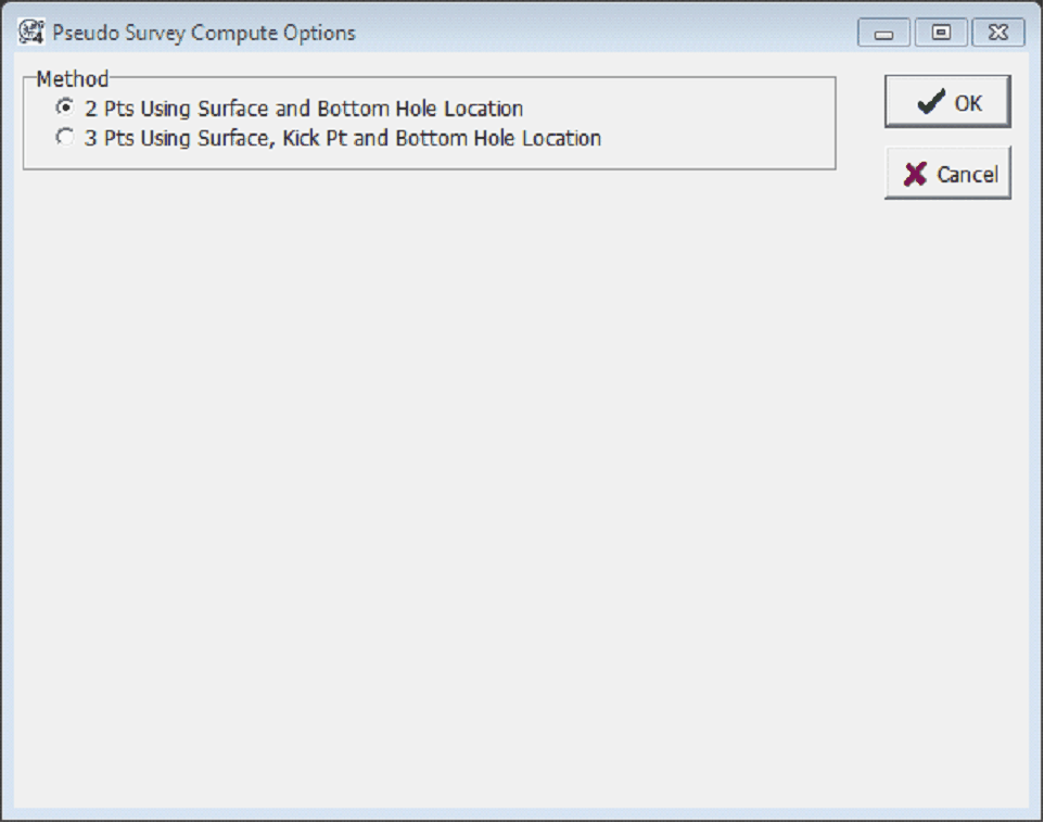
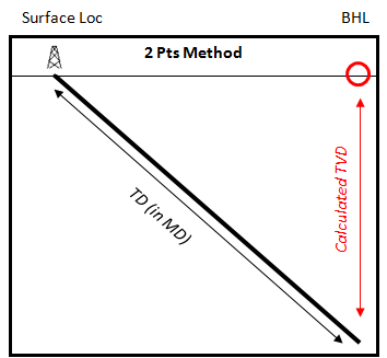
This tool calculates a pseudo directional survey from the surface location, bottom hole location, and TD. To recalculate either the surface or bottom hole locations, select Compute>From Locations>Calc Surface or Bottom-Hole Loc From Dir Survey from the menu bar at the top of the Main Module. Note that this tool will work on all selected wells. 2 Pts MethodThe 2 points method creates two directional survey points - one at the surface location, and one at the BH location. Note that Petra will assume a straight line the two using the well's TD as a distance. Importantly, this method will grossly misrepresent directional wells
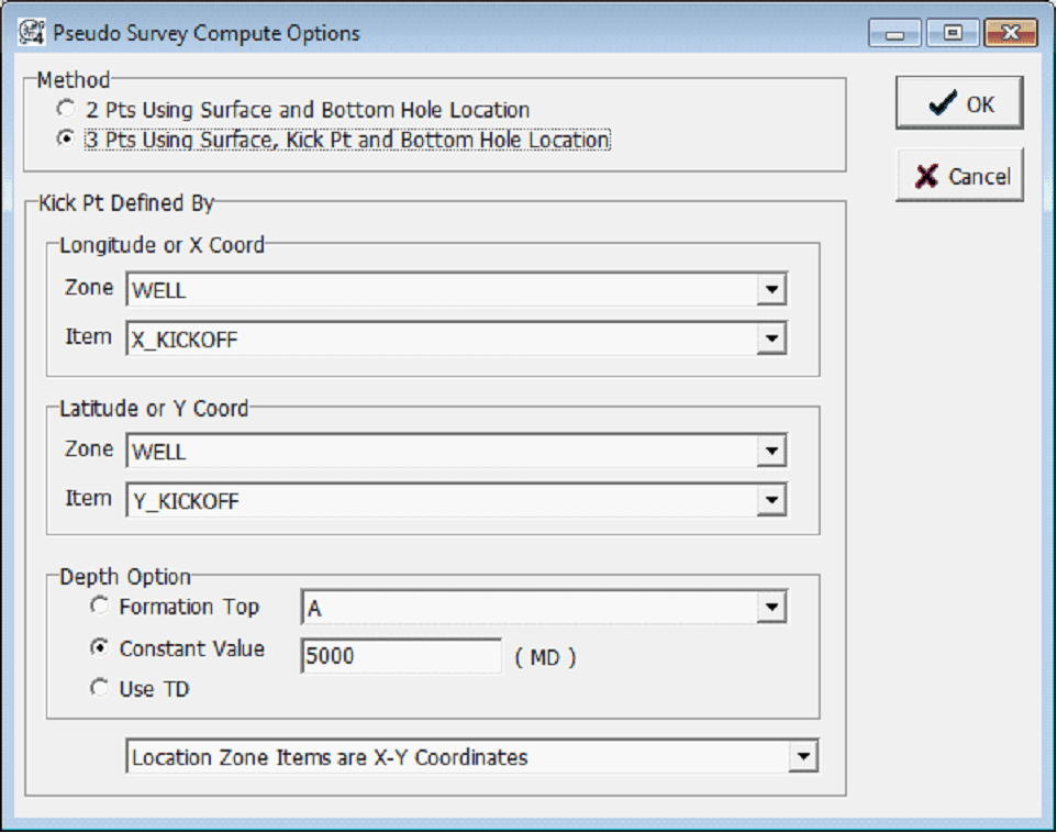
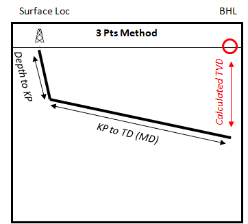
3 Pts Method
Longitude or X Coord - These dropdowns select the zone and data item containing the longitude, X coordinate, or offset of the kick off point. The dropdown at the bottom of this window will set what the selected data item represents. Latitude or Y Coord - These dropdowns select the zone and data item containing the latitude, Y coordinate, or offset of the kick off point. The dropdown at the bottom of this window will set what the selected data item represents. Depth Option - This option sets the kickoffpoint's depth. This entry can be either set to a formation depth, constant value in measured depth, or the well's TD. Location Zone DropdownLocation Zone Items are Lat-Long Values - This dropdown sets the kickoff points as latitude and longitude values. Location Zone Items are X-Y Coordinates - This dropdown sets the kickoff points as X and Y Location Zone Items are XY Offsets From Survey Location - This dropdown sets the kickoff points as X and Y offsets from the surface point. Kick Point Same as Surface Location - This dropdown sets the kickoffpoint as being directly beneath the surface location.
|