Map data limits |
|
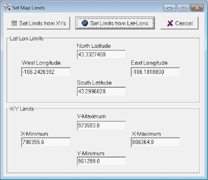
Data limits define the maximum aerial extent of the data that Petra keeps in memory and can display. Put another way, data limits define how far you can zoom out. Data limits can be set to automatically extend to cover the selected wells, the overlay, or an arbitrary area from XYs or Lat-Lons. To change the data limits, select Display>Data Limits>.... Auto Limits From Data - This option sets the data limits around the wells displayed on the Map Module. Note that this option isn't affected by disabled wells. This option is on by default, and is a great choice for most interpretation work. Selecting a different set of wells can change the extents of the map module. Set/Enter Limits - This option manually sets the map limits by either LatLons or XYs.
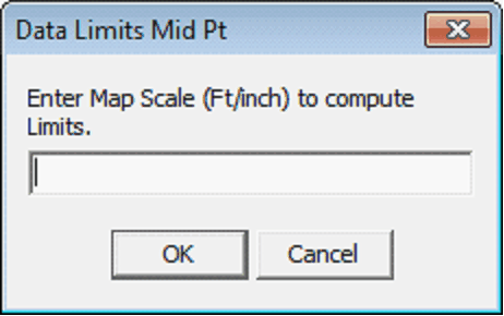
Set Mid Pt and Scale - This option manually sets the center of the map and the map scale. First, select the center of the map, and then manually set the map scale in ft/inches.
Load Limits - This option replaces the currently set limits with the limits from an external *.LIM file. Save Limits - This option saves the current limits to an external *.LIM file. Save Limits for PetraSeis Limits - This option saves the current limits to an external *.LIM file, suitable for use in PetraSeis. Use Overlay Extents - This option sets the limits based on the extents of the elements in the loaded overlay file. Note that this option will use the extents of al elements in the overlay, whether they are displayed or not. Some culture data (like country outlines) are huge and will zoom very far out. |