Plotting Interval Data in the Map Module |
|
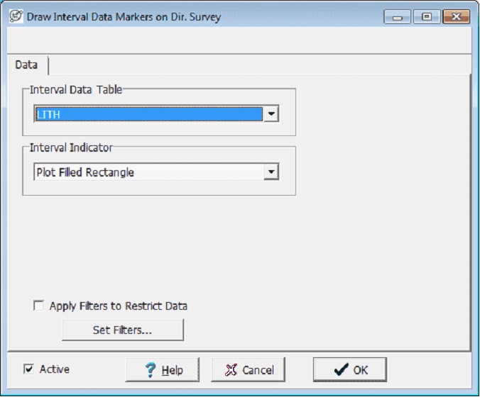
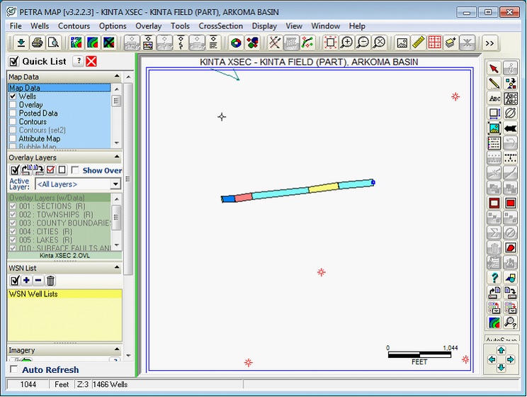
The Map Module can show and grid interval data on deviated and horizontal wells. Petra can show a rectangular area with the intervals pattern and color along the wellbore, each intervals marker symbol, or both. Intervals are a good way of showing the encountered lithology, or for quickly showing the wellbores footage spent in, above, or below a target stratigraphic unit. Plotting Interval ColorsInterval colors are plotted in a filled rectangle along the wellpath. This is useful for aerially representing continuous information in a wellbore, such as changes in lithology, biostratigraphic assemblages, or even gas shows. In the Map Module, select Options>Interval Data on Well Path Select the appropriate interval table to display from the dropdown, and select the Plot Filled Rectangle option under the Interval Indicator dropdown. With this option, Petra fills the rectangle with each intervals color. Filters provide more control over which intervals are displayed on the Map Module. Intervals that do not meet the filter criteria are not displayed. To create or modify a set of filters, select the Set Filters button on the Filters tab.. For more information on filters see the Using Filters section of this document.
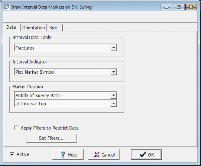
Plotting Interval Data MarkersInterval markers are along the wellpath at the top, middle, or base of the interval. Unlike the filled rectangle, interval markers can be plotted at a user-defined orientation. Interval markers are useful for representing discrete markers, such as fractures or MWD tool changes. In the Map Module, select Options>Interval Data on Well Path Select the appropriate interval table to display from the dropdown, and select the Plot Marker Symbol option under the Interval Indicator dropdown. Next, select the position of each intervals marker relative to the wellbore (middle, left, or right of the wellbore) and the position of the marker along the interval (top, base, midpoint). Note that filters can also be applied to the interval data; only intervals meeting the filter criteria are shown. In the example below, the Fractures interval table stores a horizontal line marker for every interval.
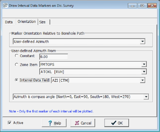
To set the direction of each marker, select the Orientation tab. Markers can be perpendicular to the borehole, parallel to the borehole, or have a user-defined orientation, or azimuth. This user-defined azimuth can either be a constant azimuth for all interval markers in all wells, set for all intervals markers for each well by a zone data item, or for each individual interval in each well by an interval data field. When storing individual fractures in a wellbore, storing azimuth data in each interval captures the most information and allows for each marker to have its own orientation. In the example below, the AZI data field gives the compass azimuth for each fracture.
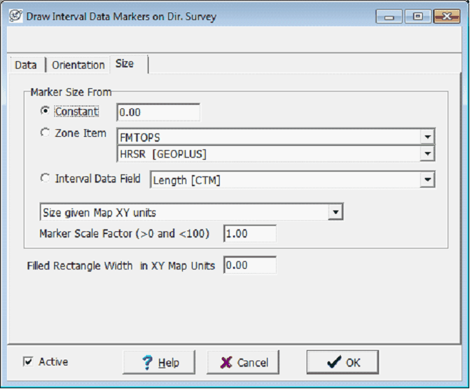
To set the size of each marker, select the Size tab. The size of each marker can either be a constant for all interval markers in all wells, set for each well by a zone, or for each individual interval in each well by an interval data field. Note that the marker size can either be set to use map XY units, feet, or meters. Selecting a constant size of 0 sets a default marker size, as shown in the example below. The Marker Scale Factor can scale the size of a zone- or interval field-defined marker by anything between 0 and 100.
|