Advanced tab |
|
The Advanced tab is used to re-project the entire project to use a new reference datum and coordinate system. This involves recalculating the LatLon and XY of every wellspot, overlay layer, grid and other associated files. Make sure to have a backup of the entire project before attempting this. 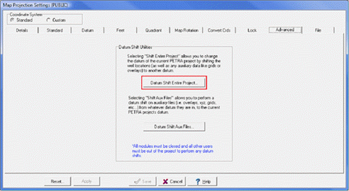
|