|
This option determines the computed location of the well symbol relative to the well's surface location.
To set the location of the directional well symbols, select Wells Directional Survey>Set Location Depth.
Data tab
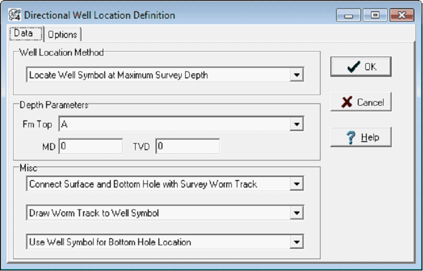
Well Location Method
Maximum Survey Depth - Well symbols are spotted at the position of the deepest survey depth.
Formation Top Depth - Wells are located at a depth defined by a formation top.
Measured Depth - Wells are located at a specified measured depth value.
True Vertical Depth - Wells are located at a specified TVD value.
Actual Bottom Depth - Wells are located at a specified BD value.
Depth Parameters
This section is used to specify the location depth selected in the Well Location Method.
Misc
The surface location can be connected to the bottom-hole location by either a straight line of by drawing the actual survey "worm" track.
When the worm track is drawn, it can extend all the way to the maximum depth location or stop at the well symbol.
When the Formation Top Depth Well Location Method is used, you may select to spot the well symbol associated with the formation top instead of the normal well symbol.
Options tab
Do Not Drop Survey Worms For Regional Scaled Maps - By default, the survey worms are dropped from scaled maps for clarity and performance.
|