|
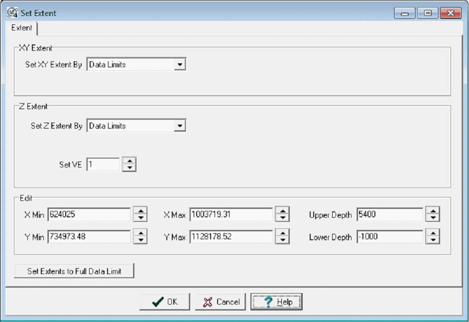
XY Extent
|
This section sets the aerial or map extent of the 3DViz module.
- Set XY Extent By - Populates the X and Y min and max extents.
|
|
Z Extent
|
The Z Extent sets the upper and lower boundaries of the 3DModule.
|
|
Edit
|
- X Min - This entry sets the east boundary of the 3DViz Module.
- X Max - This entry sets the west boundary of the 3DViz Module.
- Y Min - This entry sets the north boundary of the 3DViz Module.
- Y Max - This entry sets the south boundary of the 3DViz Module.
- Upper Depth - This entry sets the upper boundary of the module in SSTVD.
- Lower Depth - This entry sets the lower boundary of the module in SSTVD.
|
|
Set Extents to Full Data Limit
|
Sets Extents to the full data limit available.
|
 button on the 3DViz module toolbar