|
Click Here for a "How-To" guide on creating Contour Grids
Horizontal wells commonly pop in and out of a specific interval of stratigraphy. Each occurrence of this bed boundary is a potentially useful data point. One of the best ways to capture this information is with multiple, related formation tops.
In the example below, the wellbore enters the target rock once at point A, exits the interval at point B, and enters again at point C. Every time the wellbore crosses this boundary, it creates a potentially useful data point with a latitude, longitude, and a TVD value.
Petra can only store one named top for each well, so its necessary to create a set of tops. Its usually best to keep this simple by simply naming the tops successively. In the example below, points A, B, and C are named Sycamore1, Sycamore2, and Sycamore3. All three tops reflect the same stratigraphic surface, but at three different points on the same wellbore.

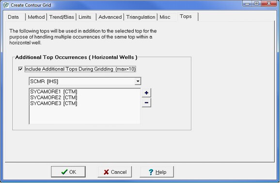
This tab aliases multiple formation tops on horizontal wells to a single formation top during gridding. In the example below, gridding the SCMR top will also use the SYCAMORE1, SYCAMORE2, and SYCAMORE3 tops as additional data points.
Its worth noting that TVD values of these tops from horizontal wells commonly dont line up with existing subsea maps and is usually wrong in multiples of 30. Pipe tally errors can easily add or subtract footage from MD. A single wrong MD leads to incorrect calculations of TVD for every successive survey point.
|