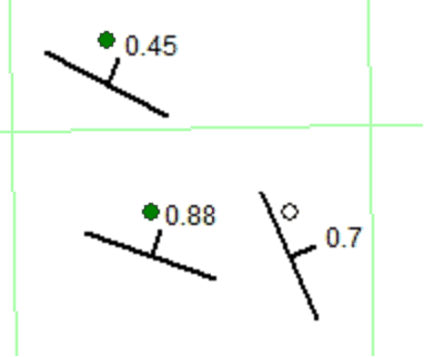
Dip Symbols |
|
The Dip-Azimuth Indicators tool adds dip and strike indicators to the Map Module. Petra can either use dip and strike from zone data, or from an external data file. Note that dip symbols from zone data are limited to well locations, while external data files can display anywhere on the map. To add dip highlights, select Options>Dip Symbols from the menu bar at the top of the Map Module
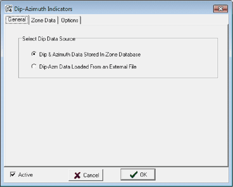
General tabThe General tab sets the data type for the dip and azimuth data. Petra can either use dip and azimuth data from a data item in the database or from an external file.
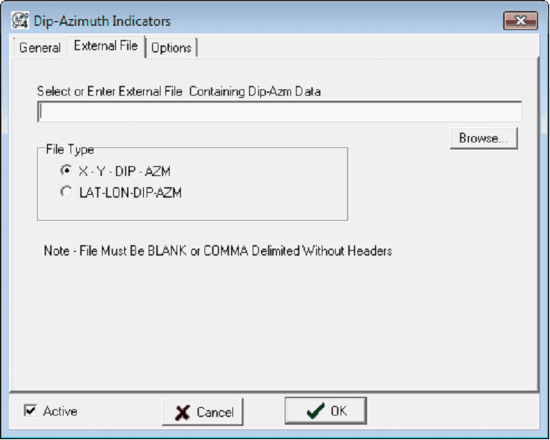
Dip & Azimuth Data Stored in Zone Database - This option sets the dip and azimuth for each well from two zone items. This plots dip and azimuth at well locations, and will create the Zone tab. Dip-Azm Data Loaded From an External File - This option loads dip and azimuth from an external text file. This option isn't limited to posting dip and azimuth at well locations, and can actually plot the symbols anywhere on the map. This option requires access to the external file - moving or changing the file name will remove the dip symbols. This will create the "External File tab. Zone Data/External File tab
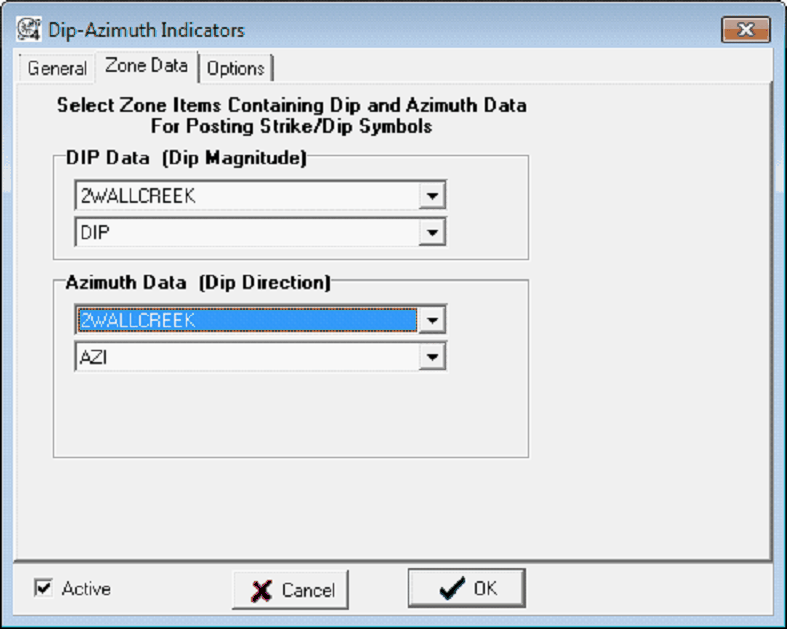
Dip DataThese two dropdowns set the location of the dip data item. The upper dropdown sets the zone, and the lower dropdown sets the specific data item. Azimuth DataThese two dropdowns set the location of the azimuth data item. The upper dropdown sets the zone, and the lower dropdown sets the specific data item. Options tab
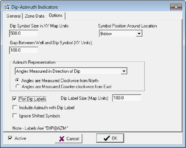
Dip Symbol Size - This entry sets the size of the dip symbols in map units. Since these symbols are in map units, they will enlarge and shrink with zoom. Symbol Position Around Location - This dropdown sets the position of the dip symbol around the well symbol. Dip symbols can be above, below, left, right, and centered right on top of the well symbol. Gap Between Well and Dip Symbol (XY Units) - This entry sets the spacing between the well and dip symbol in map units. By default, this is set to 100 units. Since this distance is in map units, it will enlarge and shrink with zoom. Azimuth RepresentationThere are a few different conventions for strike compass directions. This section tells what the azimuth numbers actually represent. Angles Measured in Direction of Dip/Strike - This dropdown specifies whether the azimuth value represents the compass direction of the dip or the strike. Angles Measured in Clockwise from North - This option sets the azimuth as measured clockwise from north. North is 0, East is 90, South is 180, and West is 270. Angles Measured in Counter-clockwise from East - This option sets the azimuth as measured counterclockwise from East. East is 0, North is 90, West is 180, and South is 270.
Plot Dip Labels - This option adds labels for the dip. Deselecting this option will just add the dip symbols. Dip Label Size - This option sets the size of the dip label. Since this distance is in map units, it will enlarge and shrink with zoom. Include Azimuth with Dip Label - When the "Dip Label Size" option is selected, this option appends the azimuth data to the end of the dip label. Ignore Shifted Symbols - This option posts the dip symbol at the original well location when well symbols have been shifted. |