Map Measuring Tools |
|
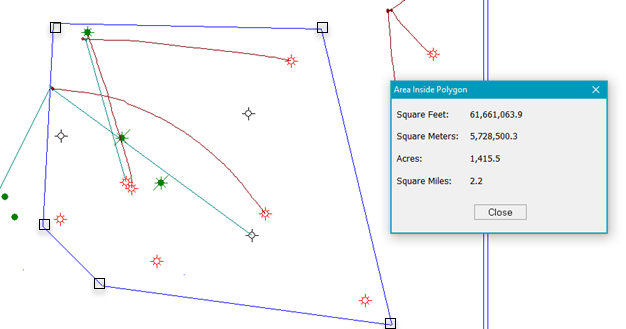
Map: Tools > Measure Distance...Map: Tools > Compute Area Inside a PolygonPetra provides two tools for quickly measuring the distance or area on a map:
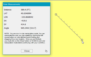
Map Measure toolThe Measure Distance tool displays the distance and other information between two points on a user drawn line. To measure a linear distance:
To display the endpoint's XY location instead of LatLon points, select the "Measure Tool Shows XY instead of LatLon" option on the Map Margin and Preferences tool. To display distances in miles/kilometers rather than feet/meters, select the "Measure Tool Shows MILES or KM" option on the Map Margin and Preferences tool. Compute area inside a polygonThe compute area inside a polygon tool quickly calculates and displays the area of a polygon. To measure the area of a polygon:
|
 .
.