|
The Thematic Mapping Module can handle multiple shape files with different map projections. Some shape files have a *.PRJ file that contain the shape file's map projection information. For shape files without the PRJ file, however, you'll need to set the file's map projection manually.
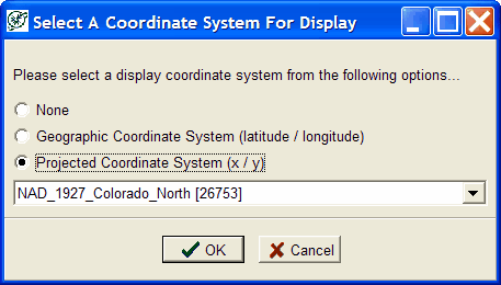
When there are two or more themes with different projections, you'll need to pick one. PetIn addition to setting the coordinate system for each shape file or theme, it will be necessary to set the "display coordinate system" if you have different coordinate systems for two or more themes . You will be prompted automatically when adding a theme that differs from previously loaded themes.
Theme Coordinate System
Shape files will be in one of two ESRI coordinate systems:
"Geographical Coordinate System" - The shape file contains latitude-longitude coordinates. Typically, we have either NAD27 or NAD83 lat-lon coordinates.
"Projected Coordinate System" - The shape file contains xy coordinates based on a specific map projection, such as, UTM or State Plane.
Display Coordinate System
The Display Coordinate System is the lat-lon "unprojected" or xy projected coordinate system of the displayed map. That is, you may display the map as either unprojected latitude-longitude or as projected xy coordinates using a given map projection. Unprojected lat-lon displays may not look correct due to lat-lon lines being drawn as straight lines. Distance queries require a projected display for accuracy.
The Display Coordinate System can be changed anytime using the "options" menu.

|