Custom (Coordinate Systems) tab |
|
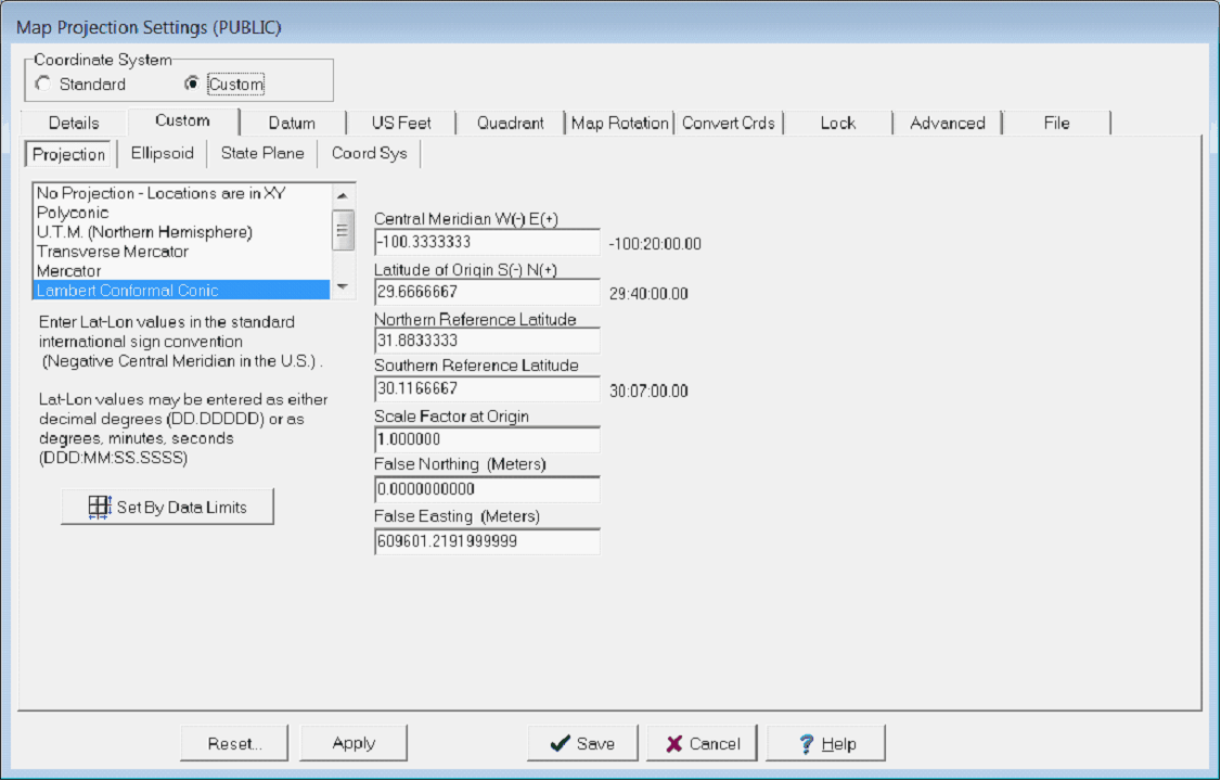
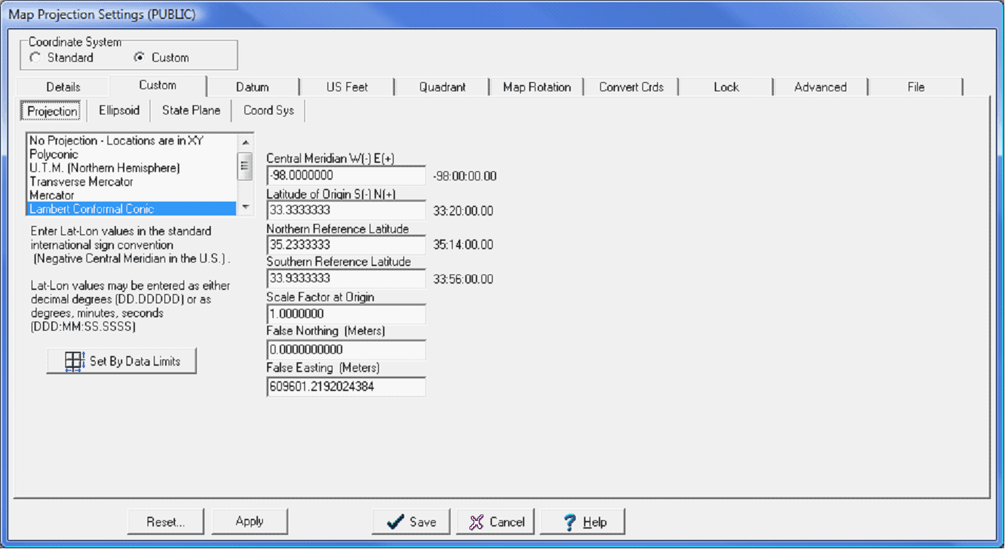
Petra contains two ways of selecting a coordinate system: Custom and Standard. Both the Standard and Custom tab set a new projects coordinate system and also reproject an entire project to use a different coordinate system (provided the reference datum stays the same). Most commonly, the Custom coordinate system provides backwards compatibility for Petra projects older than October 2008. Older projects with Custom coordinate systems can either be left alone, or easily converted into the analogous Standard coordinate system. Custom coordinate systems are also useful for handling obscure coordinate systems not included in the Standard coordinate system list. Additionally, a custom coordinate system can create a unique and highly accurate map projection for a small area. Its important to note, however, that XY locations based on a custom map projection will not be compatible with XYs from standard map projections such as state planes. This can cause difficulty in giving XY locations to drillers, for example. The Custom tab can create and modify coordinate systems in three ways: creating a coordinate system from scratch, modifying an existing coordinate system, or creating a coordinate system based on data limits. Projection tabThe Projection tab sets the specifics of the map projection.
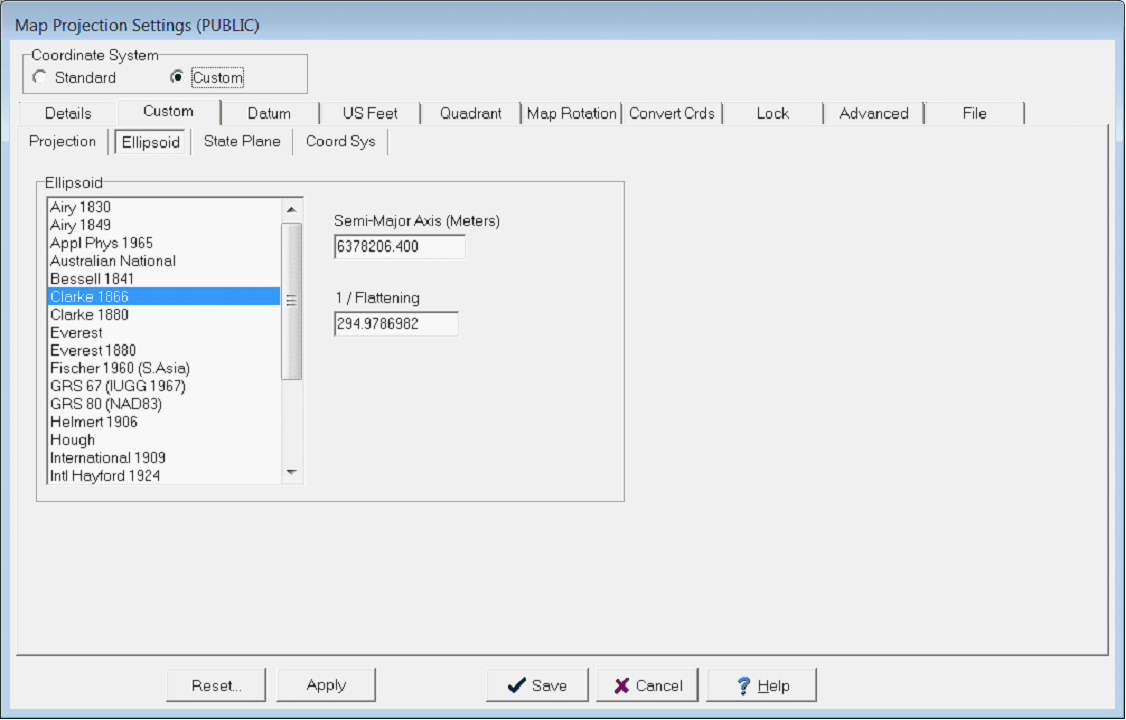
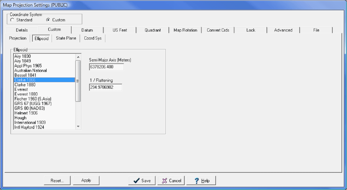
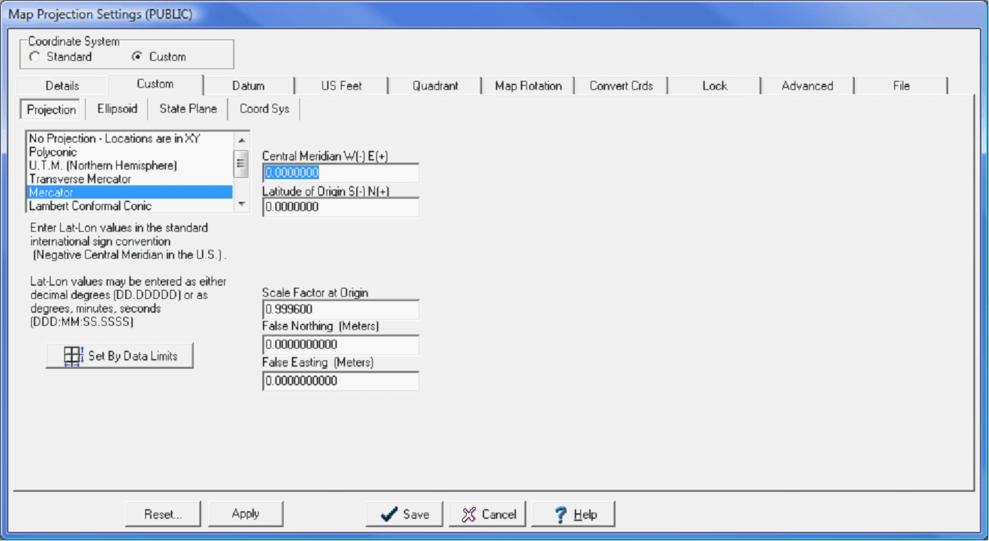
Central Meridian - This option sets the longitude of the center of the map projection. Latitude of Origin - This option sets the latitude of the center of the map projection Northern Reference Latitude - This option sets the northern reference latitude. Southern Reference Latitude - This option sets the southern reference latitude. Scale Factor at Origin - The scale factor is the ratio between distances in the projection and distances on the surface of the reference ellipsoid. This option sets the scale factor at the origin. False Northing (Meters) - This option specifies the Northing/Y coordinate at the origin of the projection. False Easting (Meters) - This option specifies the Easting/X coordinate at the origin of the projection. Elipsoid tabThe Ellipsoid tab selects the ellipsoid (spheroid) model to use with the projection. The semi-major axis and inverse of the flattening are displayed. Please note that ellipsoids are not used in XY mode.
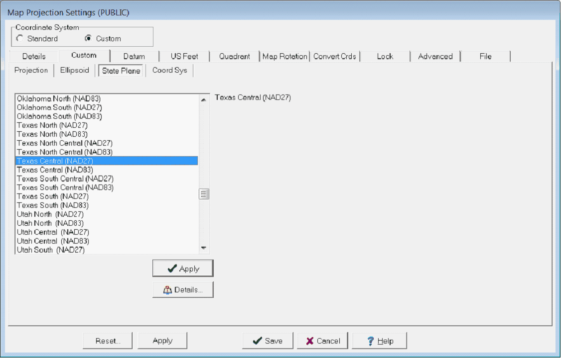
Petra stores its ellipsoid parameters in Ellipsoid.DAT, located in the installation's PARMS subdirectory. This file can be modified if extreme care is taken to maintain the format integrity. AIRY, "Airy 1830", 6377563.396, 299.3249753 AIRY, "Airy 1849", 6377340.189, 299.324964 APL49,"Appl Phys 1965", 6378137.000, 298.25 AUST, "Australian National", 6378160.000, 298.25 Example text from Ellipsoid.DAT showing the code, name, semi-major axis, and flattening of several ellipsoids State Plane tabOn the State Plane tab, set the appropriate name on the "Apply" button. Note that the "Details" button can be used to view the parameters prior to selection. The State Plane table contains parameter settings for both the North American Datum 1927 (NAD27) and the North American datum 1983 (NAD83).
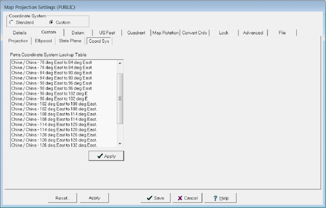
Coord Sys tabThe Coord Sys tab contains several coordinate systems from China and Israel. To use one of these coordinate systems, select one from the list and click the 'Apply' button.
Creating a Coordinate System from ScratchAfter selecting a project reference datum (on the Datum tab), select the Custom Coordinate System. On the Elipsoid tab, select the desired ellipsoid. Make sure the projection and associated ellipsoid match the chosen Reference Datum.
Selecting an ellipsoid for a custom coordinate system Next, on the Projection tab, select the specific projection type and projection parameters such as central meridian. Petra will accept LatLon values in either decimal degrees or as degrees:minutes:seconds. Note that the parameters listed will depend on the specific projection type. As an example, only the UTM projection lists UTM zones.
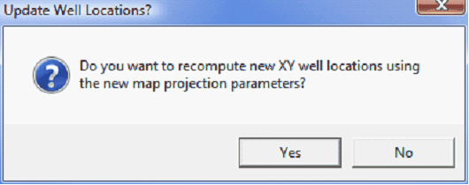
Selecting a projection for a custom coordinate system Select Save to enact the changes. For new projects this will simply set the projects map projection. For existing projects, saving a different coordinate system means that the XYs of all the data will need to change as well. Make sure to select Yes when Petra asks to recompute XY well locations using the new map projection. See Final Steps later in this help file to reproject grid files.
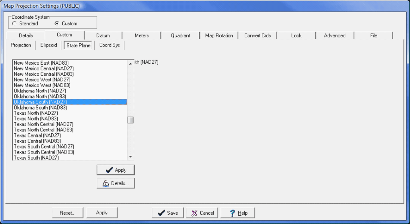
Changing the coordinate system changes the XY positions of wells. Select "Yes" to recompute the positions in the database. Modifying an Existing Coordinate SystemThe Custom tab also contains the coordinate system settings for the US state plane system (under the State Plane tab) as well as Israel and China (under the Coord Sys tab). To modify one of these existing coordinate systems, select the coordinate system from either the State Plane tab or the Coord Sys tab. In the example below, the Oklahoma South (NAD27) state plane coordinate systems is selected. Once youve selected the coordinate system to modify, Select Apply to temporarily set the coordinate system.
Selecting an existing state plane populates the other tabs with the coordinate systems values Going back to the Custom tab shows that all the settings for the given coordinate system are loaded in. Every one of these settings is now modifiable.
The Projection tab with the selected state plane's projection settings Select Save to enact the changes. For new projects this will simply set the projects map projection. For existing projects, saving a different coordinate system means that the XYs of all the data will need to change as well. Make sure to select Yes when Petra asks to recompute XY well locations using the new map projection. See Final Steps later in this help file to reproject grid files.
Changing the coordinate system changes the XY positions of wells. Select "Yes" to recompute the positions in the database.
Creating a Coordinate System Set by Data LimitsThe Set By data Limits option creates a new map projection using the selected projection type and the extents of the wells selected in the Main Module. This option essentially fills in the blanks for the central meridian and latitude origin based on the extents of the selected wells. Select Save to enact the changes. For new projects this will simply set the projects map projection. For existing projects, saving a different coordinate system means that the XYs of all the data will need to change as well. Make sure to select Yes when Petra asks to recompute XY well locations using the new map projection. See Final Steps later in this help file to reproject grid files.
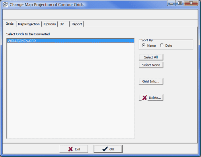
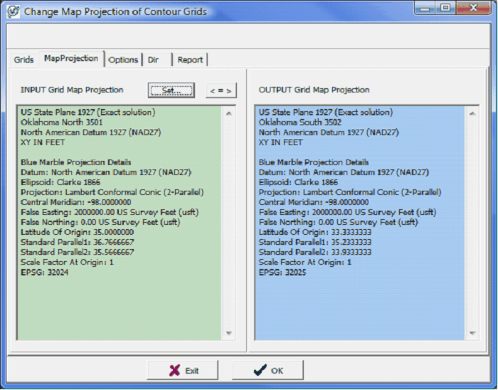
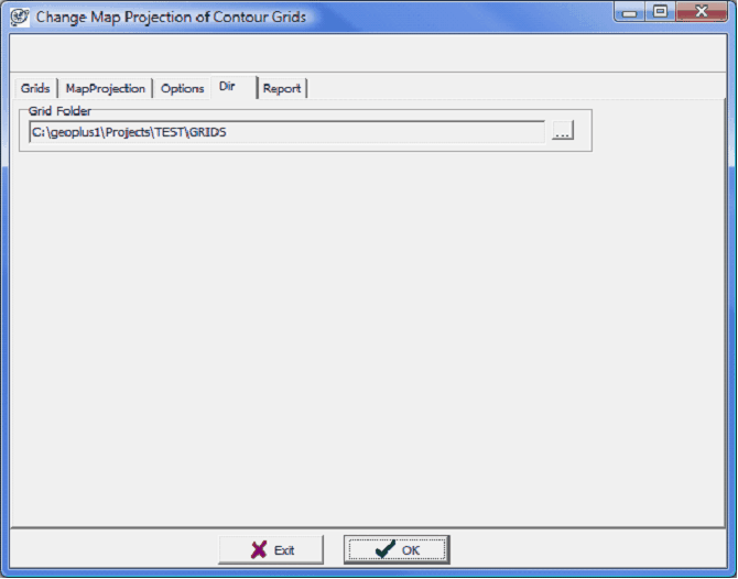
Changing the coordinate system changes the XY positions of wells. Select "Yes" to recompute the positions in the database. Final Steps for Changing the Coordinate System on an Established Project After changing the coordinate system and the projects map projection, there are a couple more steps to reproject other data inside a project. Reopen the map module, and verify that the well locations and overlay files line up correctly. It might be necessary to reset the data limits to reflect the new locations of the well and overlay data. To do so, select Display>Auto Scale Mode & Map Extents From Wells. The wells and overlay should now be lined up using the new coordinate system. The final step here is to reproject the grids. Select Contours>Grids>Convert Grid Map Projections. The Grids tab shows the grids contained inside the projects GRIDS folder. To change this directory, select the Dir tab. Next, select the grids to reproject. The MapProjection tab shows the map projection of the grids on the left in green and the new grid map projection on the right in blue. Notice that in this example, the grid was Oklahoma North (NAD27) and will be reprojected to Oklahoma South (NAD27).
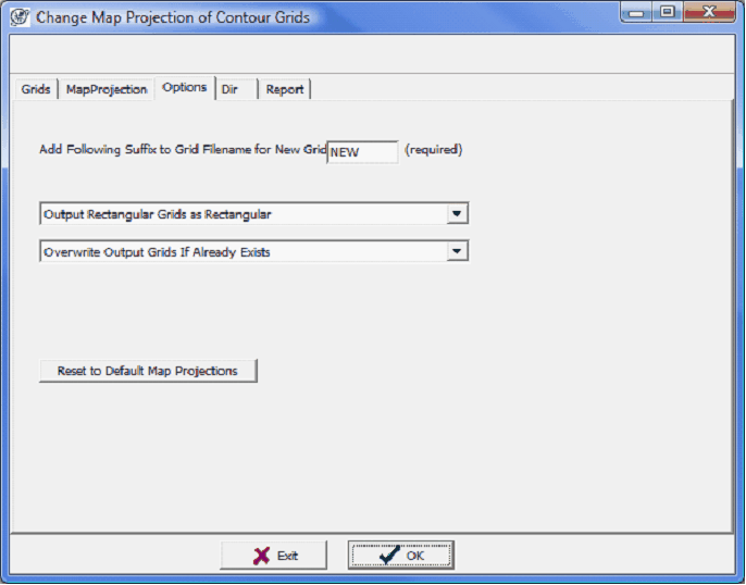
The Grids tab (left) and Map Projection tab (right) The Options tab gives a little finer control on how the grids will be reprojected. Petra automatically stores backup copies of all reprojected grids. By default, Petra adds NEW as a suffix to new grids. Its possible to change it by entering new text, but there needs to be some text here. This tab also controls how Petra resamples the existing grids to fit the new projection. You can output the newly reprojected grids as rectangular or triangular grids. The Dir tab changes the directory of reprojected grids. This tool will only reproject grids within this folder. If your grids are stored in multiple folders, its probably best to perform this operation several times to get all different folders. To reproject the grids, select OK. Petra will review the selected grids and generate a report.
The Options tab (left) and Dir tab (right) |