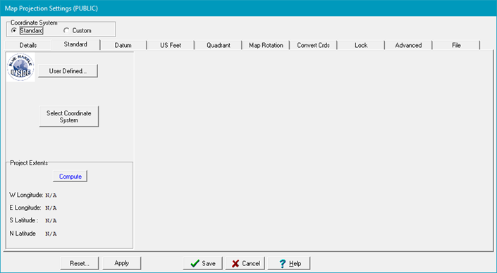
Standard (Coordinate Systems) option


When the Standard coordinate system is selected you can select either :

  • User Defined...—This option allows you to access Blue Marbles custom coordinate settings which are beyond the scope of this help document. Therefor, this option should only be used by knowledgeable qualified persons. For more Information, contact Blue Marble Geographics
  • Select Coordinate systems —The Coordinate Systems option contains a wide variety of coordinate systems assembled by Blue Marble Geographics.  This set of Standard coordinate systems covers the vast majority of projections used in the oil and gas industry.

 Both options set a new project's coordinate system and also re-projects an entire project to use a different coordinate system (provided the reference datum stays the same).  

After changing the coordinate system and the project's map projection, you should also convert the auxiliary files using the Advanced tab.