Display Contour Grids |
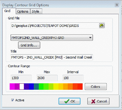
Contours > Display Contour Grid menu itemContour maps can be generated from grid files produced by the "Create Grid" function. Both contour lines and color-filled contours can be produced. To create a contour grid:
Grid tabThe Grid tab sets the specific grid displayed on the Directional Well Module'sMap View.
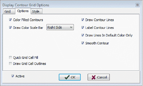
Options tab
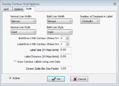
Style tabThis section provides control over line thickness, line style, and labeling interval. Contour lines are drawn as either "normal" or "both" state.
|