3DViz Map Images |
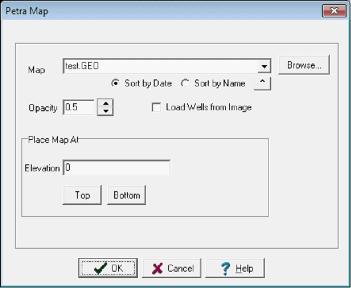
Map: File > Print To...> 3dViz ImageMap images generated by the Petra map module may be displayed at a specified elevation on the 3D display. The map images contain a well list which may be used with the image by checking the Load Wells from Image check box Adding the Map Image:To add the image file:
Creating a *.GEO FileThe first step is to displaying a map on the 3DViz module is to create a:
The JPG is a simple image file, while the *.GEO file sets the specific location of the image on the 3DViz Module.
|
||||||
|
|
 button on the