Adding / reloading data sources
You can add multiple data source types to the Spatial Explorer map. Each data source you add to Spatial Explorer includes all the data layers available from that source. If the data source requires credentials, you are prompted to enter these credentials the first time you connect to the data source. Each data source has its own authentication window. See How to add a data source
For each data layer you add to the map, you must provide an identifying name for the layer. Spatial Explorer uses this identifying name in the Data Source and Layers lists.
| Data Source | Method for Adding |
|---|---|
|
WMS services Portals: ArcGIS; Spatial Energy Feature services |
Provide a valid URL Note that unlike a typical feature service, feature services in Spatial Explorer are read-only. |
|
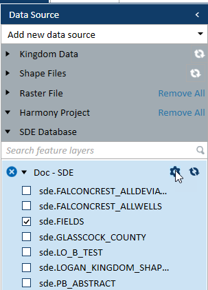
SDE database |
Provide a file path and a database name. After you add an SDE database as a data source, you have the option to update the X and Y boundaries used for spatial queries to ensure any data added from the geodatabase is included in these queries. See Updating spatial queries, and adding shape & image files You can also define the AOI (Area of Interest) for all SDE layers by clicking the gear beside the SDE database name under Data Source in the left pane of Spatial Explorer. |
|
Browse to and locate the shape file, raster file, or geodatabase folder. Like the SDE database, you can update the spatial queries for geodatabases. You can also add shape files and image files |
|
|
Project data |
Select the following project data directly in Spatial Explorer (deviation surveys are included with well selections):
|
|
(Kingdom only) Drag and drop |
Drag and drop from Project Explorer onto the Spatial Explorer Data Source panel:
|
|
Text layers are native to Spatial Explorer and do not need to be imported or added from the Kingdom or Harmony project. |
|
|
Polygon layers are native to Spatial Explorer and do not need to be imported or added from the Kingdom or Harmony project. |