Label Settings
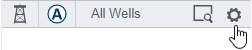
To access label display settings for wells, beside the well layer, click the Settings icon.
Note that to display the label display settings, you must first select a label Location in relation to the well symbol: Top, Right, Bottom, Left, Center. This option is at the top of the dialog box.
Additional display settings included the following:
|
Show |
Select to show the title (name) of the attribute and/or the units. |
|
Priority |
This option determines the order in which labels for data points display on the map when the map scale and density of information causes labels to overlap one another. |
|
Positioning |
This option etermines how labels are positioned when overposting occurs. See Positioning priority and rules |
|
Concatenate Labels |
When selected, all attributes for the label display as a single line. |
|
Font |
Click the down arrow to select the font and style (bold | italics). |
|
Color |
Applies to all labels |
|
Background |
Select a background color for the label |
|
Font size |
Fixed - size in points |
With Harmony data, you can add labels using both Attributes and Results. With Kingdom, double-clicking a well also opens Well Explorer with that well selected.
Not all attributes are available for all data types.
Specific steps for adding or changing the layer and well labels are below. Workflows may vary slightly depending on the data type selected.
If you want to display tool tips for wells visible on the map, click Tool Tip, then select data you want to include in the tool tip, along with the display order.
- Click
 next to a layer name in the Layers list.
 - Click Display Properties and then click the Label Settings tab.
- Select a label location (Top, Center, Bottom, Left, and Right).
- From the Attributes list, select one or more attributes you want to display in the selected location.
- Select a display priority and positioning rule for the label display location.
- Select the font, font size, font color, and emphasis (bold or italics).
- If needed, select a background color.
- If you want to display the data type name (Title) or the unit of measure (Units) for the attribute, select the Title and/or Units options.
- Determine whether to display the attributes for the selected location by clicking
 (this option is selected by default).
 - Repeat Steps 1 - 9 for each label location where you want to display data.
- When you are finished, click OK.
Your steps may vary slightly depending on the data type you are modifying and the display options available for that data type.
- Click next to a layer name in the Layers list.
- Click Label Settings or Add Label, depending on the data layer you selected.
- Select a label location (Top, Center, Bottom, Left, and Right). For wells, you also have the option to select ToolTip. Note that using Center for a well does not display.
- Select a data type, name, and attribute you want to display (you can use the Shift key to multi-select names and attributes) and use the Arrow buttons to add your selection(s) to the Selected Data list. You can select Attributes, Results, Wells, Zones, or others.
- Select a display priority and positioning rule for the label display location.
- Select the font, font size, font color, and emphasis (bold or italics).
- If needed, select a background color.
- If you want to display the data type name (Title) or the unit of measure (Units) for the attribute, select the Title and/or Units options.
- Determine whether to display the attributes for the selected location by clicking (this option is selected by default).
- Repeat Steps 1 - 9 for each label location where you want to display data.
- When you are finished, click OK
Sizing Equation
The sizing equation is as follows:
Text height = (map unit*96/map scale) where 96=pixels per inch
Positioning priority and rules
For each label location (center, left, right, above, and bottom), you can define both a position priority and a positioning rule. These options determine how labels for data points display on the Spatial Explorer map when the map scale and density of information on the map causes labels to overlap one another. The label priority determines which labels take display precedence over other labels. Label priority ranges include highest, high, medium, low, lowest, and automatic (a priority of automatic means Spatial Explorer determines display priority for you).
Based on order of priority, Spatial Explorer then applies the positioning rules assigned to each label location. The default rule "Fixed location with overposting" maintains the assigned label location and allows the label to be overlapped by other labels that need to display in the same location. The rule "Fixed position or remove" means that Spatial Explorer will leave the label in its assigned location, or remove it from the display if another label with a higher priority conflicts with the display location. The rule "Reposition or remove" moves the label location so the label can display without any overlaps, or removes the label from the display if a suitable location cannot be found.
Saving and loading label setting templates
After you define display properties for attribute labels, you can save these settings as a template or use with other data layers, or you can load an existing template to use on the data layer you have selected.
- Using the steps above, define the label display properties you want to save as a template.
- Click Save Template.
- Browse to the location where you want to save the template (.ltf) file.
- Type a name for the template file in the File name field.
- Click Save.
- Click next to a layer name in the Layers list.
- Click Display Settings.
- Click the Label Settings tab.
- Click Load Template.
- Browse to and select the template file (.ltf) you want to use.
- Click Open.
Related Topics