Display Contour Grids |
Top Previous Next |
|
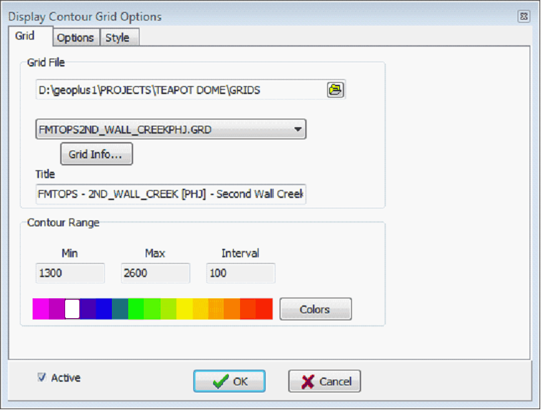
Contour maps can be generated from grid files produced by the "Create Grid" function. Both contour lines and color-filled contours can be produced. To create a contour grid, open the Contours>Display Contour Grid menu item or click on the Display Contour Grid button on the icon bar. Grid tabThe Grid tab sets the specific grid displayed on the Directional Well Module'sMap View.
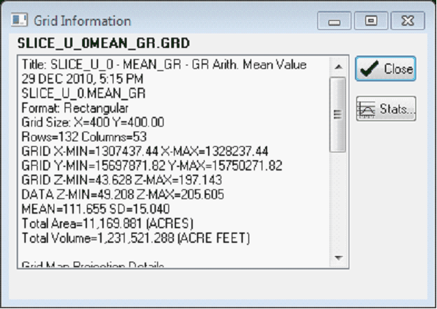
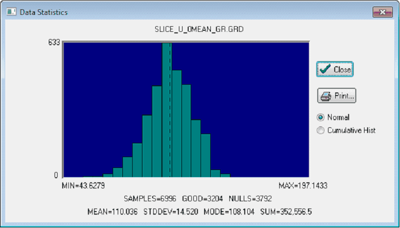
Grid FileThis section sets the specific grid file for the contours on the Map View. Grid File Directory - This entry sets the location of the available grid files (*.GRD). By default, this tool will look in the project's GRIDS directory. Grid Dropdown - This drop down sets the grid file that will produce the contours. Note that this list contains only the grid files stored inside the Grid File Directory selected above. The files are listed from newest to oldest date created. Grid Info - This button shows information about the selected grid file. This includes the title, dimensions, and grid spacing. For a histogram and more detailed statistics on the grid's Z values, select the "Stats" button.
Contour Range This section sets the minimum, maximum, and contour interval for the contours. This tool will automatically calculate default values, and will apply a rainbow Color bar. Colors - This button opens the Enhanced Color Interval Definition tool, which allows for much greater control over the contour Color bar. This tool can apply a preset color bar, or set individual colors for each interval. Options tab
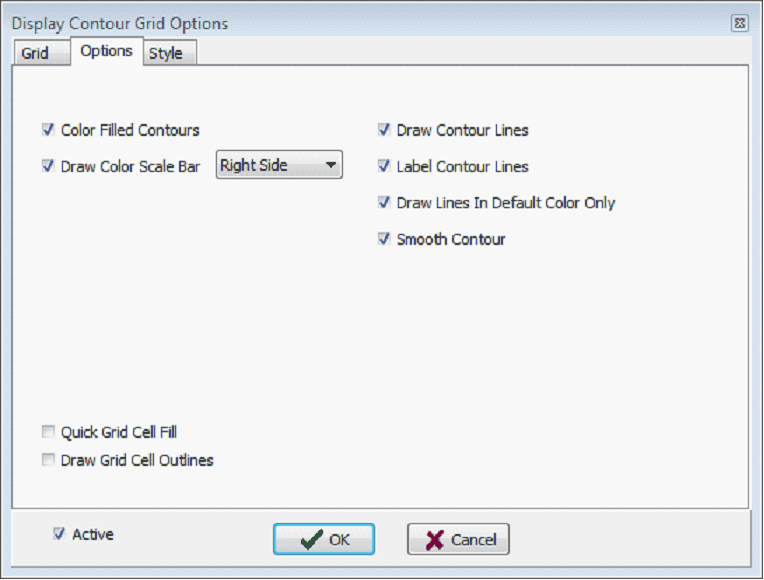
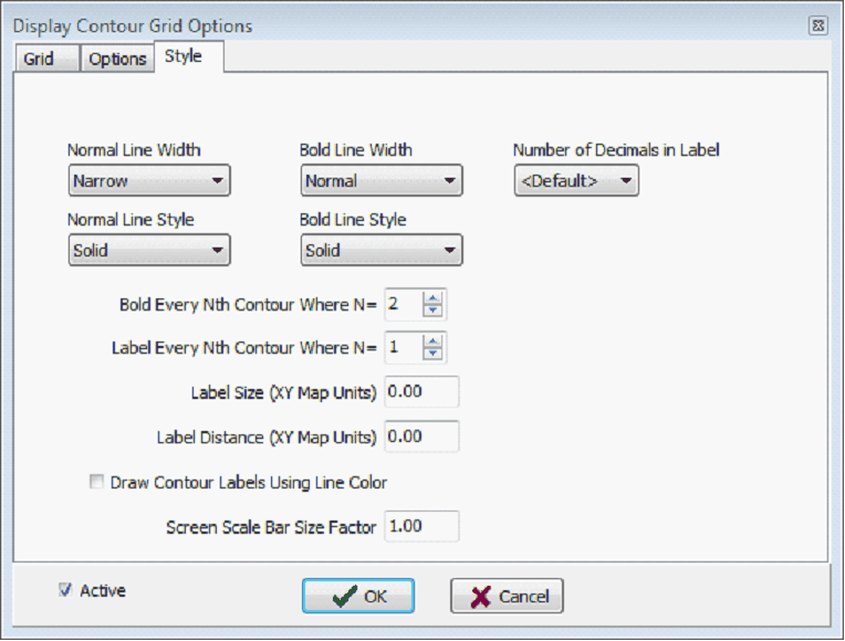
Color Filled Contours - This option uses the Color bar set on the Grid tab color-fill the gridded surface. Deselecting this option will turn off the color fill. Draw Color Scale Bar - This option draws a small color scale showing the color associated with each contour interval. The adjacent dropdown selects the location of the scale bar, which can be either on the upper left or upper right side of the map Draw Contour Lines - This option draws contour lines on the grid. These lines will start at the "Min" contour range on the Grid tab and proceed up to the "Max" contour range using the contour "Interval" value. Label Contours - This option control whether any contours are labeled. Refer to the style tab for labeling options. Draw Lines In Default Color - By default, Petra draws contours using the colors from the Color bar. This option instead draws all contour lines using the default color (which is usually black). To change the default color, select Display>Colors on the menu bar at the top of the Map Module. Smooth Contour Lines - This option smooths contour lines. For jagged or triangular grids, this may force grids to not "honor the data." Quick Grid Cell Fill - This option will color fill each grid cell with a single color. Color contour bands are not drawn. Draw Grid Cell Outlines - This option causes grid lines to be drawn along each grid row and column. This can be useful for demonstrating the resolution of the grid relative to the actual data points. Style tabThis section provides control over line thickness, line style, and labeling interval. Contour lines are drawn as either "normal" or "both" state.
Normal Line Width - Select the line width for drawing contour lines in the normal state. Normal Line Style - Select the line style for drawing contour lines in the normal state. Bold Line Width - Select the line width for drawing contour lines in the bold state. Bold Line Style - Select the line style for drawing contour lines in the bold state. Bold Every Nth Contour Where N= - Set the interval at which bold contours are drawn. Label Every Nth Contour Where N= - Set the interval at which contour lines are labeled. Label Size (XY Map Units) - The height of the contour labels in XY map units. Set the size to zero for the default of 0.1 inches. Label Distance (XY Map Units) - The distance between contour labels in map XY units. Set the distance to zero for default value. |