|
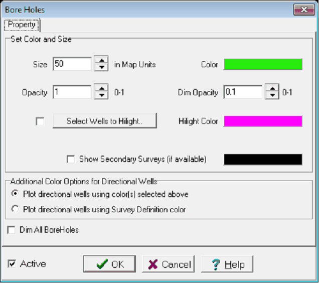
Size
|
Sets the well bore diameter in map units. As an example, setting this option to "50" will create well bores with a diameter of 50 meters or feet. This is useful for illustrating borehole location (displaying them at actual diameter would make them very difficult to see), but can be misleading about the proximity of very closely spaced wells (like sidetracks).
|
|
Color
|
Sets the color for the boreholes on the 3DViz module. Select the rectangle to set a different color.
|
|
Opacity
|
Sets the opacity of all wellbores on a scale from 0 (transparent) to 1 (completely opaque).
|
|
Dim Opacity
|
This tool dims all wells except the selected well. Dimmed wells can have an opacity anywhere from 0 (transparent) to 1 (completely opaque).
|
|
Select Wells to Highlight
|
Uses a Select Wells By Data Criteria to highlight selected wells with a different wellbore color.
|
|
Highlight Color
|
Sets the color for the optional highlight.
|
|
Show Secondary Surveys
|
Stores "Primary" and "Secondary" directional surveys, but the 3DViz module only displays the "Primary" survey by default. This option enables both the primary and secondary surveys for all directional wells.
|
 button on the on the